Search by artist, work title or style – e.g. Monet, Starry Night, Impressionism, Hokusai wave, nude. Describe the scene – e.g. green meadow, abstract with lots of red, dark oil painting, standing nude next to a tree.

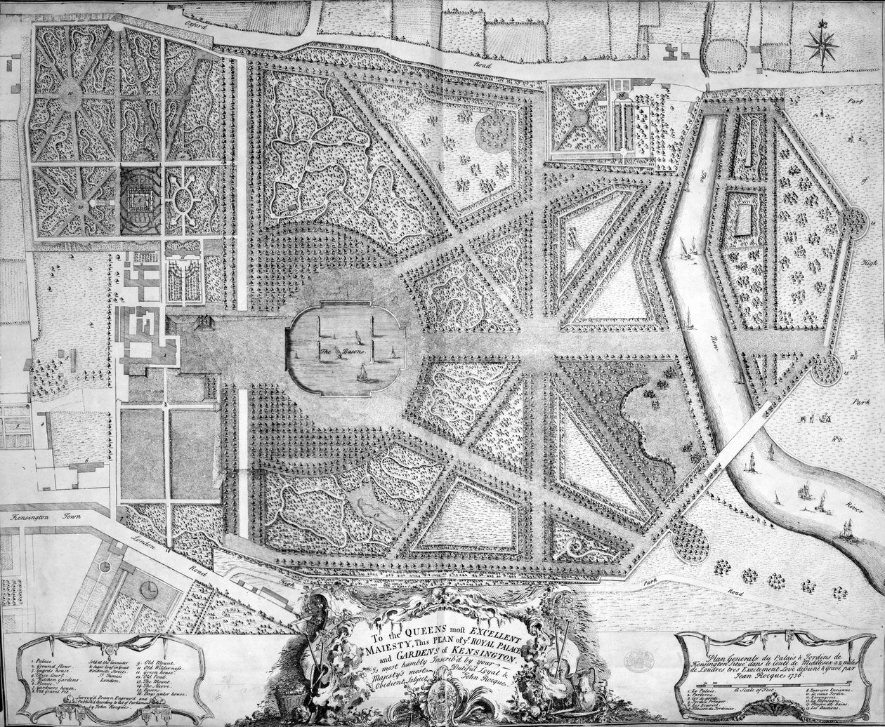
A Map of the Royal Palace and Gardens of Kensington, London, 1736 by John Rocque

A Map of the Royal Palace and Gardens of Kensington, London, 1736

(A Map of the Royal Palace and Gardens of Kensington, London, 1736 )


John Rocque

€ 129.47
Enthält 13.5% MwSt.
   Configure art print
1746  ·  Gravur  ·  Picture ID: 90318

Victorian Art  ·  Cartography

A Map of the Royal Palace and Gardens of Kensington, London, 1736 by John Rocque. Available as an art print on canvas, photo paper, watercolor board, uncoated paper or Japanese paper.
kensington · palace · garden · high park · hyde park · gardens · plan · birds-eye view · formal · avenues · avenues · trees · river · london · middlesex · cartography · royal · residence · building · city · street · streets · england · english · britain · british · capital city · georgian · kensington gardens · Middlesex · Private Collection / Bridgeman Images
Other color variations of this picture  
AR/3D   View in 3D / AR zu Favoriten hinzufügen   Add to favorites    Select wall color    View painting in a room
0 Reviews

Configure art print

Picture Frame

Medium & Stretcher

Glass & Passepartout

Miscellaneous & Extras

 Save / compare configuration
Preview Icon

Summary

Gemälde
Veredelung
Keilrahmen
Museumslizenz

€ 129.47
(inkl. 20% MwSt)
   Add to cart

Bildschärfe: PERFEKT

Should you desire adjustments to brightness and color, or a custom crop of the motif, we are happy to make these changes at no additional cost to you. Please do not hesitate to contact us.

Similar artworks selected for you

Plan of Kensington Palace (detail) by Joshua Rhodes, 1764 A Map of Chelsea, 1746 An Exact Plan of the Gardens and Park at Wilton, the seat of the Earl of Pembroke, 1746 Plan of the Royal Garden of the Medicinal Plants in Paris, 1641 A Topographical Survey of the Parish of Kensington with Plans and Elevations of the Royal Palace and Gardens, Hyde Park and Knightsbridge Plan of Lord Harley A Map of The King General Plan of the Town and Chateau of Versailles, with Its Gardens, Forests and Fountains A Map of Marylebone, London, 1746 Abbaye de Bourgueil, General Plan Charles Bridgeman A Map of Tothill Fields, London, 1746 A New Plan of the Town, Château and Gardens of Versailles, 1714 Badminton House in the County of Gloucester The Villa d Londonderry Besieged by General Hamilton and Conrad de Rosen, engraved by J. Sturt, 1689 Route of James II Map of Fontainebleau castle from Civitates Orbis Terrarum by Georg Braun Map of Racconigi, Engraving by Joan Blaeu, Italy Paris: The Palace and Garden of the Tuileries in 1615, Facsimile of Mathieu Merian Plan of the First Works at Versailles Copper Engraving - Abbey and Market Berchtesgaden Plan of the Gardens of the Emperor of Peking, from Jardins Anglo-Chinois a la Mode, by George Louis le Rouge, published c.1776-78 A Map of the West End and Soho, London, 1746 A Map of Bloomsbury and Holborn, London The District of the College des Quatre Nations (Four Nations) and the Hotel Conti-Fac-Simile in the Plan of J. de la Caille Abbey Notre Dame du Bec. General view in 1677
Show more similar artworks

Other art prints by John Rocque

An Exact Plan of the Gardens and Park at Wilton, the seat of the Earl of Pembroke, 1746 A Map of the Royal Palace and Gardens of Kensington, London, 1736 A Map of Clerkenwell, City of London, 1746 A Map of Shoreditch and Whitechapel, London, 1746 A Map of Moorfields and Hoxton, London, 1746 An 18th Century Map of London. An Exact Survey of the Cities of London, Westminster, the Borough of Southwark and the Country Near Ten Miles Around Begun in 1741 & Ended in 1745 by John Rocque Land Surveyor & Engraved by Richard Parr A Map of the West End and Soho, London, 1746 A Map of St. James A Map of Bloomsbury and Holborn, London A Map of the Tower of London, 1746 Map of Battersea & Chelsea, 1748 A Map of Camberwell, London, 1746 A Map of Old London Bridge, London, 1746 A Map of Wapping, London, 1746 A Map of The King
Discover more works by John Rocque

Other motives from the category Cartography

A Map of Clerkenwell, City of London, 1746 Map of Lower New York State and surrounding areas, c.1775 Map of the Battle of Trafalgar, published by William Blackwood and Sons, Edinburgh and London Scene of the Zodiac including a Galleon (detail) Map of Animals in Europe Map of the Battle of the Nile, published by William Blackwood and Sons, Edinburgh and London, 1848 Map of Delft, from Map of Berlin, printed by C.L. Keller, Berlin, 1890 Map of Vienna, published by Klimsch und Co., Frankfurt, c.1860 Map of the Ottoman Empire, Kingdom of Greece, and the Russian Provinces on the Black Sea Map of Luneburg, from Map of Scotland, c.1700 Map of the City of New York Map of Amsterdam, from World Map, from
View More from "Cartography"

Excerpt from our top sellers

The Tropics The Meurthe Boating Party The Artist The Magpie Poppy Field Evening with Clouds The Great Wave off Kanagawa The Grand Canal, Venice, Looking Southeast, with the Campo della Carità to the Right, 1730s Watercolor No. 606 The Quiet River, 1913 Children The Langlois Bridge at Arles with Washerwomen Midsummer Eve The Attic Room View of the Naruto Whirlpools at Awa, from the Series
Show More Artworks


What our customers think about us


Frequently Asked Questions about Meisterdrucke


Personalizing your art print at Meisterdrucke is a simple and intuitive process that allows you to design an artwork exactly to your specifications: Choose a frame, determine the image size, decide on a printing medium, and add suitable glazing or a stretcher frame. We also offer customization options such as mats, fillets, and spacers. Our customer service is available to help you design your perfect artwork.

At Meisterdrucke, you have the fascinating option to visualize the artwork you configured directly in your own space. For a tailored preview, simply upload a photo of your room and let the artwork appear on it. If you visit us via a mobile device, be it a phone or tablet, our augmented reality feature brings the image to life and seamlessly projects it into your space. An experience that uniquely combines art and technology.

Choosing the medium is often a matter of personal taste. To give you a clearer idea, we have provided some images for each medium. For a holistic experience, we also offer you a sample set of all paper variants so you can make a decision not just visually but also haptically. You can take advantage of the sample set free of charge – only the shipping costs will apply. You can order the sample set directly.

Do not worry. At Meisterdrucke, we do not proceed mechanically. We manually review each order. If there are any inconsistencies or peculiarities in the configuration, we will immediately contact you. Of course, our courteous and patient support is always at your side to assist you with the configuration. Together with you, we adjust your image by phone or email so that the final result exactly meets your expectations.


Do you have any questions?

Are you interested in an art print from our manufactory but still unsure? Do you need advice on choosing the medium or help with the order?

Our experts are happy to assist you.

+43 4257 29415
support@meisterdrucke.com
Mo-Do: 7:00 - 16:00 | Fr: 7:00 - 13:00

Do you have any questions?

Are you interested in an art print from our manufactory but still unsure? Do you need advice on choosing the medium or help with the order?

Our experts are happy to assist you.

+43 4257 29415
support@meisterdrucke.com
Mo-Do: 7:00 - 16:00 | Fr: 7:00 - 13:00


Meisterdrucke

   Kärntner Strasse 46
        9586 Finkenstein am Faaker See
        Austria
        +43 4257 29415
        support@meisterdrucke.com
Other languages

                   
Erfahrungen & Bewertungen zu Meisterdrucke
Post.at DHL Express Quehenberger Cargoboard
Kaiser Franz Joseph

Meisterdrucke
Kärntner Strasse 46
9586 Finkenstein am Faaker See · Austria
+43 4257 29415 · office@meisterdrucke.com
Post.at DHL Express Quehenberger Cargoboard


Meisterdrucke 2755 Bewertungen auf ProvenExpert.com

(c) 2025 meisterdrucke.ie